DEN → Snowmass Village · Roaring Fork Valley
Denver Airport to Snowmass Car Service
221 miles from the Level 5 curb to your lodge door in Snowmass Village: I-70 over the Divide, Glenwood Canyon, then up the Roaring Fork Valley and Brush Creek Road.
Snowmass is a long way past the ski towns most people know
Vail is roughly the halfway point. Past it the road drops through Glenwood Canyon and turns back up a second valley, so the plan for this transfer starts with the canyon, not the airport. Live road status is on our DEN operations center, the traction rules are in the Colorado traction law guide, and ski and snowboard gear is counted before the vehicle is assigned. A delayed flight never cancels the ride.
Denver International Airport to Snowmass Village is 221 road miles, about 4 to 4.5 hours in clear conditions, by I-70 west to exit 116 at Glenwood Springs, then Highway 82 up the Roaring Fork Valley and Brush Creek Road into the village. Arion runs it as a private, per-vehicle transfer in an electric sedan, SUVs and vans, with the flight tracked and the chauffeur waiting on Level 5. The rates below are one-way base rates; a free quote confirms yours.
The Road
Exit by exit, from Peña Boulevard to Brush Creek Road
The car leaves the Level 5 curb, runs out Peña Boulevard and picks up I-70 westbound across the north side of Denver. The mountains start at Morrison, which is also where Colorado's I-70 traction-law zone begins. From there it is a steady climb past Idaho Springs and Georgetown to the Eisenhower-Johnson Memorial Tunnel, which tops out at 11,158 feet and is the highest point of the whole trip. Most first-time passengers expect the tunnel to be the hard part. On a Snowmass run it is barely a third of the way.
West of the tunnel the interstate drops into Summit County past Silverthorne and Frisco, then climbs again over Vail Pass at 10,662 feet. Vail Pass is one of the corridor's usual storm trouble spots: long grades where one stuck truck can stop both lanes. Down the far side comes Vail, then Eagle and Gypsum, and at Dotsero (exit 133) the traction-law zone ends and Glenwood Canyon begins.
The canyon carries I-70 for about twelve miles along the Colorado River, much of it on stacked bridge decks with walls rising well over a thousand feet above the water. There is little or no shoulder. At exit 116 the car leaves the interstate for Highway 82, signed for Aspen, and threads through Glenwood Springs before the road opens out into the Roaring Fork Valley. The official Snowmass visitor directions put it at about 32 miles of Highway 82: Carbondale, El Jebel and Basalt, then the right turn onto Brush Creek Road at the Brush Creek Park & Ride.
Brush Creek Road is the last climb. It winds up out of the valley floor into the village, and Snowmass is built in layers along it. Snowmass Base Village sits at about 8,400 feet at the bottom of the lifts, the Snowmass Village Mall is higher at about 8,606 feet, and Two Creeks is a separate, lower base at the edge of the ski area at about 8,110 feet. The Mall is a pedestrian street, so for a lodge on it the car uses that building's own drive or loading area, and your chauffeur takes the bags in. At a private home, give us the gate code before landing; the last few hundred feet of a steep driveway in January matter more than the previous 220 miles.
Glenwood Canyon is the part of this trip that can change
Everything before Dotsero has alternatives or at least predictability. The canyon has neither. CDOT closes I-70 between exit 116 and exit 133 for serious crashes, for rockfall, and for mud and debris flows off the 2020 Grizzly Creek burn scar. Its burn-scar protocol has changed over the years: earlier summers saw the canyon closed whenever a flash flood warning was issued, and in 2025 CDOT moved to monitoring conditions and keeping the highway open where it could. We do not guess from old rules. We look at the live status before the car leaves DEN, and again from Eagle.
When the canyon is shut for more than a short hold, the detour is long. CDOT's signed route leaves I-70 at Wolcott on Highway 131 to Steamboat Springs, follows US 40 west to Craig and Highway 13 south to Rifle, then rejoins I-70 heading east to Glenwood Springs. In 2016 CDOT measured that loop at 146 miles longer than the canyon and about three hours more. CDOT also asks drivers to stay off Cottonwood Pass, Hagerman Pass and other county and forest roads as shortcuts; they are not built for the traffic. If the closure looks short, waiting it out in Eagle or Gypsum with a coffee usually beats the loop. That is a call your chauffeur makes with dispatch, with you in the loop.
The pass you will not use in winter
Independence Pass carries Highway 82 over the Continental Divide at 12,095 feet between Twin Lakes and Aspen. CDOT closes it for the winter on or near November 7 and almost always reopens it on the Thursday before Memorial Day; in 2026 it opened on May 21. From early November to late May there is no route to Snowmass from Denver except I-70 to Glenwood Springs. In summer the pass is open, but it is narrow and slow, it is posted against vehicles over 35 feet, and it comes into the valley at the Aspen end, past the turn for Snowmass. For a Snowmass drop it is a scenic choice, not a faster one.
DEN to Snowmass Village: Rates, Seats & Luggage
Rates below are one-way DEN–Snowmass Village base rates.* 9.3% sales tax, 4% credit-card processing and, where applicable, a 12% fuel surcharge (waived on all-electric Luxury Sedan trips) are added at booking. Gratuity is never automatically added or assumed; 20% is customary. Your quoted rate is normally at or below the figure shown — a free quote confirms it in minutes.
Matching The Car To The Group
Four hours is long enough that the wrong vehicle shows
On a 40-minute airport run you can squeeze. On 221 miles with a tunnel, two climbs and a canyon, nobody wants a ski bag across their knees. These are the pairings that work on this route.
One to three travelers, light bags: Luxury Sedan
The 2023 Mercedes EQS 450 is all-electric and seats three with three bags. With no engine, the cabin is quiet for four hours, and the fuel surcharge is waived. It is the wrong choice for skis; if gear is coming, move up to an SUV.
Up to five with ski gear: Executive or Luxury SUV
The Executive SUV is an older mid-to-high trim model that seats five with room for eight standard bags. The Luxury SUV is a late-model flagship trim, such as an Escalade, Navigator L or Yukon Denali, and seats six, but from November 1 to April 30 we cap it at five so skis and boots fit. A family of four with full gear is a comfortable Luxury SUV load.
Six to nine: Jet Van or Executive Van
Nine seats and a real cargo area. This is where two families sharing a condo at Base Village end up, and it is usually less per person than two SUVs.
Up to twelve: Luxury Coach Van
For wedding parties, corporate offsites and big ski groups. Tell us the ski and boot bag count, not just the headcount; twelve people with gear is a different load from twelve people with carry-ons.
Larger groups can move in a limousine or a bus on a custom quote. Bus arrivals on Brush Creek Road and at the base areas need a little more planning, so give us the lodge name early.
Timing
When to land, and when the road is worst
The I-70 pattern is predictable. Westbound backs up on Friday afternoons and Saturday mornings, eastbound fills from early Sunday afternoon into the evening, and holiday weekends stretch both. On a four-hour transfer, landing on a weekday or early on a Saturday saves more time than any shortcut. A Friday 4 p.m. landing puts you in the heaviest westbound traffic and gets you to Glenwood Canyon after dark, which is legal and safe but slower.
From September 1 through May 31, Colorado's Passenger Vehicle Traction Law applies on I-70 between Morrison and Dotsero whenever CDOT activates it. When it is on, vehicles need AWD or 4WD with adequate tires, snow tires, or chains or another approved traction device. Chain law, the stricter step, requires chains or an approved device on every vehicle. CDOT can activate either on any state highway, so Highway 82 and Brush Creek Road are not exempt. Our mountain vehicles run AWD or 4WD on winter tires, which is why a snowy forecast changes our timing, not whether the trip runs.
For the return, work backward. Allow the 4 to 4.5 hours of the drive, add about an hour for winter or a Sunday, then add two hours before a domestic flight or three before an international one. That is why Snowmass guests on a Sunday afternoon flight home are usually in the car before breakfast.
Why DEN matters more when the Aspen airport closes
Aspen/Pitkin County Airport (ASE) is only a few miles from Snowmass; Owl Creek Road links Highway 82 near the airport to the village. In a normal year it is the closest airport by far. From 11:00 p.m. on Sunday, April 4, 2027 to 7:00 p.m. on Friday, November 19, 2027, it is closed for a full runway rebuild and a new passenger terminal, with no commercial flights at all.
For those seven and a half months every Snowmass arrival comes by road. Eagle County (EGE) is the closest substitute, and Grand Junction is another, but Denver International has by far the deepest schedule in the region, with nonstops from nearly anywhere at nearly any hour. For international travelers, for groups arriving on several flights, and for anyone whose airline does not serve Eagle, DEN is the practical answer, and this 221-mile drive becomes the standard way into Snowmass.
Two details are easy to miss. First, the closure starts before the ski season ends: Snowmass is scheduled to run through April 11, 2027, so the last week of spring skiing falls inside the closure. Second, the whole summer calendar sits inside it, including the Jazz Aspen Snowmass season and the valley's wedding months. Book the ground transfer when you book the flight. Our Aspen airport closure guide has the full detail.
On Arrival
Snowmass is a ski area with a town attached, not the other way round
Aspen grew out of a silver camp and got a ski mountain later. Snowmass went the other way. It was planned as a ski resort from the start, and the village climbs the hillside along Brush Creek Road beside the runs. The mountain is the biggest of the four Aspen Snowmass areas: 3,342 acres, 98 trails and 4,406 vertical feet, according to the resort. One lift ticket covers all four mountains, and free RFTA buses run between Snowmass Village and Aspen, so a family can sleep here and still eat in Aspen.
The newer base at the bottom of the lifts, about 8,400 feet. Hotels and condos around a pedestrian plaza, with the Elk Camp Gondola close by.
The original 1967 core, higher up at about 8,606 feet. Ski-in, ski-out lodging along a walking street, and the village transit center at its end.
A quieter, lower base at the edge of the ski area at about 8,110 feet, mostly homes and condos. Worth naming at booking, because it is not where most people mean by “Snowmass.”
If we got one arrival, we would land before noon on a weekday
That one decision fixes most of this route. A weekday morning landing misses the Friday and Saturday westbound crush, puts the whole drive in daylight, and gets you through Glenwood Canyon and up Brush Creek Road with light to spare. There is time to pick up rental skis, walk the village, and be at dinner at a sensible hour instead of checking in at 10 p.m.
The second thing we would do is leave the car behind once we arrived. Free RFTA buses connect Snowmass Village and Aspen, so a dinner in Aspen does not need a driver or a designated driver. Save the Big Burn, the wide open face that made Snowmass famous, for the first full morning, when the grooming is fresh and you have slept a night at 8,000-plus feet.
Revised each season. Ask your chauffeur what the road and the mountain are doing that week.
The weather, told straight
Aspen Snowmass lists Snowmass at an average of 300 inches of snow a year, and that is measured on the mountain, not in the village. For the drive, what matters more is where the snow falls. A storm can be dumping on the tunnel and Vail Pass while Glenwood Springs, at a far lower elevation, is only wet; then Brush Creek Road climbs back into winter for the last stretch. In spring and summer the canyon, not snow, is the variable: heavy rain over the burn scar is what brings debris down onto I-70. We plan both seasons from the live forecast, not the calendar.
A short history of the place
Snowmass-at-Aspen, as it was first called, opened on December 16, 1967. Bill Janss, a former Olympic ski racer, spent years buying up ranches in Brush Creek valley and built the base village, while the Aspen Skiing Company built the lifts. Opening day had five chairlifts, and a lift ticket cost $6.50.
The valley's older history turned up in 2010. Crews enlarging Ziegler Reservoir above the village hit mammoth and mastodon bones, and the Denver Museum of Nature & Science ran an excavation of what became known as the Snowmastodon site, one of the most significant high-elevation Ice Age fossil sites found in North America.
Why Arion On This Route
What you are paying a mountain chauffeur for
The canyon is checked before the car leaves
Glenwood Canyon status, the tunnel and Vail Pass are checked at dispatch and again en route. If something closes, you hear it from your chauffeur, with a plan.
Winter-equipped vehicles
AWD or 4WD on winter tires, meeting Colorado traction law, driven by chauffeurs who run I-70 all winter.
A flight delay never cancels the ride
We track the flight and move the pickup. The reservation follows your actual landing time, and the Level 5 curb plan moves with it.
The Record
Proof, not adjectives
Zero accidents
More than 650,000 miles and 3,272 transfers since we opened on October 17, 2025, without an accident.
Clients come back
68% of our reservations come from returning clients, and we hold a 4.8 rating on 50 Google reviews.
Women-owned, PUC licensed
Arion, LLC operates under Colorado PUC license LL-04689.
Questions About the Snowmass Transfer
How long is the drive from Denver International Airport to Snowmass?
Snowmass Village is 221 road miles from DEN, and the drive takes about 4 to 4.5 hours in clear conditions. The route is I-70 west through the Eisenhower-Johnson Memorial Tunnel, over Vail Pass and through Glenwood Canyon to exit 116 at Glenwood Springs, then Highway 82 up the Roaring Fork Valley and Brush Creek Road into the village. Weekend ski traffic, traction law and storms add time, so dispatch sets the pickup plan from the live forecast rather than from the clear-day figure.
Does the car go over Independence Pass to reach Snowmass?
Not in winter. Independence Pass on Highway 82 east of Aspen closes for the season on or near November 7 and almost always reopens on the Thursday before Memorial Day, according to CDOT. From November to late May the only practical road from Denver is I-70 to Glenwood Springs and Highway 82 up the valley. In summer, when the pass is open, the Glenwood Springs route is still usually the better choice for Snowmass: the pass is narrow and slow, and it comes in from the Aspen end of the valley, past the turn for the village.
Where do you drop off in Snowmass Village?
At the door of wherever you are staying. That covers Snowmass Base Village, lodging along the Snowmass Village Mall, Two Creeks, and private homes off Brush Creek Road and Owl Creek Road. The Mall itself is a pedestrian street, so for buildings on it we use the lodge's own drive or loading area and bring the bags to the desk. Give dispatch the lodge or street address, not just “Snowmass,” because the base areas sit at different elevations and on different roads.
What happens if Glenwood Canyon closes while we are on the way?
Your chauffeur and dispatch reroute or hold, and you hear what changed and why. CDOT closes I-70 through the canyon between exit 116 and exit 133 for crashes, rockfall and debris flows off the 2020 Grizzly Creek burn scar. The official detour goes north through Steamboat Springs, Craig and Rifle; in 2016 CDOT measured that loop at 146 extra miles and roughly three extra hours. We check the canyon before the car leaves DEN, and a short closure is often better waited out in Eagle or Gypsum than detoured around.
Where do our skis and boards go?
Inside the vehicle, planned before it is assigned. Tell us how many ski or snowboard bags and boot bags are coming, and we size the vehicle to the gear, not only to the headcount. From November 1 through April 30 the Luxury SUV carries five passengers instead of six so there is room for skis. A family of four with full gear usually fits a Luxury SUV; six skiers with gear belong in a van.
When should we leave Snowmass for a flight out of DEN?
Work backward from the flight. Allow 4 to 4.5 hours for the 221-mile drive in clear conditions, add about an hour in winter or on a Sunday afternoon when eastbound I-70 backs up toward the tunnel, then add 2 hours before a domestic departure or 3 before an international one. That usually means leaving Snowmass about seven to eight and a half hours before a winter departure. Dispatch confirms the exact time the day before, once the forecast is in.
Is it better to fly into Aspen (ASE) instead of Denver for Snowmass?
ASE is much closer: Owl Creek Road links Highway 82 near the airport to Snowmass Village, so the ground leg is short. The trade-off is that ASE is a tight mountain airport with limited seats and weather diversions, while DEN has far more nonstop flights. Many Snowmass guests fly DEN because the schedule fits, then ride the 221 miles. We run both, plus Eagle County.
Does the 2027 Aspen airport closure affect a Snowmass trip?
Only if you travel between April 4 and November 19, 2027. Aspen/Pitkin County Airport closes at 11:00 p.m. on Sunday, April 4, 2027 and reopens at 7:00 p.m. on Friday, November 19, 2027 for a runway rebuild and a new terminal. There are no commercial flights into ASE in that window, so Snowmass arrivals come by road from DEN, Eagle County or Grand Junction. The 2026-27 season before April 4 is unaffected, but Snowmass is scheduled to stay open through April 11, 2027, so the last week of spring skiing falls inside the closure.
Which vehicle is right for our group going to Snowmass?
Couples and solo travelers with light luggage ride well in the Luxury Sedan, a 2023 Mercedes EQS 450 that seats three. Up to five with ski gear fit the Executive SUV or, from November to April, the Luxury SUV. Groups of six to nine take the Jet Van or Executive Van, and up to twelve fit the Luxury Coach Van. On a four-hour drive, give everyone a real seat and put the gear in the cargo area.
Where does my chauffeur meet me at DEN?
On Level 5, the baggage claim level and the only commercial pickup curb at DEN. Your chauffeur waits at Island 2, by door 511 on the east side or door 506 on the west side depending on your carousel, and texts you the exact spot before you land. Level 6 is ticketing and departures. An inside meet at baggage claim with a name sign is available for an additional $75, arranged at booking.
What if my flight into DEN is late?
We track the flight and move the pickup to your actual landing time. A delayed or diverted flight is never cancelled on our side. A diversion within Colorado is reassigned to a chauffeur in that market once we are notified, with additional charges per the rate card. On this route a late landing mostly changes the drive plan, since arriving after dark puts the car in Glenwood Canyon and on Brush Creek Road at night, so dispatch rechecks conditions for the new time.
Do traction law or chain law affect the Snowmass drive?
They can. Colorado's Passenger Vehicle Traction Law applies on I-70 between Morrison and Dotsero from September 1 through May 31 whenever CDOT activates it, and CDOT can activate traction or chain law on any state highway, Highway 82 included. Our mountain vehicles run AWD or 4WD on winter tires, and chauffeurs check CDOT conditions before and during the trip. See our Colorado traction law guide for the full rule.
Can we stop on the way, in Glenwood Springs or Basalt?
Yes. Glenwood Springs, Carbondale and Basalt are all on Highway 82 on the way in, so a grocery run, a rental-shop pickup or a meal stop costs little extra distance. Add stops when you book so dispatch can build them into the timing; a stop after dark in winter is worth planning, not improvising.
Last reviewed: September 26, 2026 by Arion dispatch. Rates, policies, travel times and Colorado Department of Transportation rules are subject to change; call (970) 703-4995 for current details.
Sources
Road rules, figures and dates on this page come from the agencies and operators that publish them. Check them yourself:
- Colorado DOT: Independence Pass seasonal closure
- Colorado DOT: I-70 Glenwood Canyon closures and alternate routes
- Colorado DOT: Passenger Vehicle Traction and Chain Laws
- Snowmass Tourism: maps and travel directions
- Snowmass Tourism: history of Snowmass
- Aspen Snowmass: mountain statistics
- Denver International Airport: passenger pickup locations
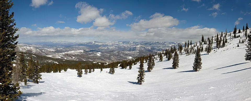
- Hero photo: Snowmass panorama from Elk Camp, by Wolfgang Moroder, Wikimedia Commons
Book your Snowmass transfer from DEN.
Because You Matter. And your ride should prove it.
Planning a 2027 trip? Aspen/Pitkin County Airport closes April 4 through November 19, 2027 for runway reconstruction, and every Snowmass arrival in that window comes by road. How to reach Snowmass and Aspen during the closure.