The Question
Somewhere past Berthoud Falls, where US-40 starts folding back on itself, somebody in the back seat always asks the same thing. Who thought this was a good place for a road?
It is a fair question. The highway climbs from the I-70 exit at Empire to the Continental Divide and drops into the Fraser Valley on grades of about 6.3 percent on both sides, with a stack of switchbacks on the south face that makes first-timers go quiet. In a normal winter it gets buried, blasted and plowed, then buried again. And it is the main way from Denver to Winter Park.
Almost nobody thought it was a good place for a road. People built one anyway, and then kept paying to keep it open.
The Assumption
Most people assume the pass is an old Indian trail or a mountain-man route that surveyors just paved over. That is how a lot of Colorado passes happened. It is not how this one happened.
The Grand County history record says flatly that the pass "had played no previous role in the history of the region," and that even Jim Bridger, who knew the country well, did not learn of its existence until the survey. The likely reason is that you can't see it. The saddle is not evident from most places on either side of the Divide. The tribes who crossed the range went over higher, farther north.
The second assumption is about the name. It is Berthoud, as in Edward L. Berthoud, the surveyor who later served as chief engineer on the Colorado Central Railroad. Who he was, and who Loveland was, gets its own piece on October 13.
The Rabbit Hole
Here is the detail that sold me on this whole article. Berthoud's party left Empire on Friday, May 10, 1861, with Bridger along as guide. His own report describes the first camp, which they named for Bridger. It was pitched, in his words, "at the side of an enormous avalanche of snow which had rushed with irresistible violence into the neighboring valley of Clear creek."
The first recorded night anyone spent looking for this road, they slept next to avalanche debris. The pass has been telling people what it is for 165 years.
Berthoud reached the summit two days later. The bronze plaque the State Historical Society put up there reads "Discovered by Capt. E.L. Berthoud, Colorado pioneer, May 12, 1861. Surveyed by Berthoud and Jim Bridger July, 1861." His report called the summit "clear of obstructions" and laid out a wagon route: west from Empire, north to the top, then down a creek he named after a man in the party, Thomas Moses. The name did not last. Moses creek is now the Fraser River.
Then came the review, and it was not kind. The pass was being scouted as a railroad route, and the railroads passed. The Grand County history of the Moffat Road notes that Surveyor General Case and a Union Pacific reconnaissance looked at both Berthoud and Boulder Pass and agreed that neither route offered much hope for a standard gauge railroad. By the next fall, a letter in the Rocky Mountain News was already promoting a different crossing as "a much better pass for a Railroad and Wagon Road than Berthoud Pass."
That is the road that shouldn't exist. It was surveyed as a railroad line, found to be the wrong place for one, and got a road anyway.
The History
From toll road to trunk highway
The wagon road took most of fifteen years. Clear Creek County's history of the route puts construction of the Georgetown, Empire and Middle Park Wagon Road at 1860 to 1875. The summit plaque says the toll road opened in 1874. Either way, it was slow and expensive. The trains, meanwhile, went somewhere else entirely. They ran over Rollins Pass starting in 1904 and then went under the Divide through the Moffat Tunnel, which opened in early 1928 after a 1926 cave-in killed six men. No railroad has ever crossed Berthoud Pass.
The car road came next. In the fall of 1919 the Forest Service and the state highway department agreed on $220,000 to build nine miles of new road over the pass. According to a 1924 Colorado Highways article quoted in the county history, the federal Bureau of Public Roads engineers stretched that money into 16.6 miles of continuous road, 18 feet wide instead of 16. That road opened in 1923, and it is the footprint US-40 still mostly follows. The author of that 1924 article compared the transformation to Cinderella's fairy godmother. Highway engineers were allowed to write like that then.
It went through a few names before it got a number. Records gathered for the county history call it the Midland Trail Auto Road and the Victory Highway, a coast-to-coast route named for the soldiers of the First World War that ran from New York to San Francisco by way of Denver and this pass. The federal numbering system came in 1925, and the county's sources show locals still calling it the Victory Highway in 1935. By 1938 it was US-40.
A 1926 motorists' guide, quoted in the same history, might be my favorite thing ever written about this road. It called the summit "the highest pass on a trunk highway in the U. S." It warned that "ice freezes almost every morning" and that "the pass is usually open from June 1st to Nov 1st." Then it reassured everyone that "some cars go over on high gear." The inn at the top served meals for a dollar to a dollar-fifty. There was no phone.
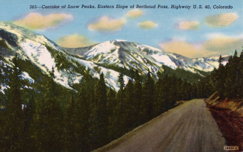
June to November was not going to work for long. In 1930 the road was widened and paved in places, with stone culverts replacing the metal ones. The sources disagree by a year or two on when the plows started winning. The county history says the pass was open year-round in 1931. The state's avalanche accident history says Berthoud Pass was the first to stay open, starting in the winter of 1932-33. Either way, it was the first Colorado pass over the Divide that people could count on in January.
Paving over the top was finished in July 1938, and the county history records a celebration and a parade at the summit. The Federal Highway Administration's history calendar marks it as the completion of the last paved segment of U.S. 40, and credits Clyde Learned of the Bureau of Public Roads with largely choosing the line. A journalist at the time wrote that "Learned has built himself in every foot of that superb surface."
After that it was a matter of keeping up with the traffic. The Grand County side was widened to three lanes in 1962. In the late 1980s there was serious talk of skipping the summit entirely. Archaeologists surveyed a route for a Berthoud Tunnel in 1987, and a Berthoud Tunnel Building Authority delivered a feasibility study in 1991. The tunnel was never built. The road that shouldn't exist kept its summit.
What got built instead was the Berthoud Pass Mountain Access Project, which ran from 1999 to 2006 and cost about $60 million. Before it, the two-lane road on the east side was only 25 feet wide in places and carried about 7,000 vehicles a day. Crews widened it to three lanes with shoulders wide enough to hold plowed snow, and built sediment basins to catch the 3,000 to 4,000 tons of traction sand CDOT spreads there every winter. They added wildlife underpasses, including one sized for lynx. To keep Winter Park reachable, the contract allowed no lane closures while the ski resort was operating. The Federal Highway Administration gave it an environmental excellence award in 2005.
The ski area at the top
Once the road stayed open, people drove up it with skis. The skiing came before the ski area. In the 1930s, according to the state's ski historians, the thing to do was drive to the top, send one car to the bottom, and have everyone but the driver ski down. By 1938 the Rocky Mountain News counted 26,000 of Colorado's 66,000 skiers using Berthoud Pass.
The lift story, as it is told, starts with a group of Denver skiers back from Sun Valley in 1936, sketching a tow on butcher paper at the Navarre restaurant downtown. What is documented is that the May Company and Denver's Ford dealers paid for it. Yes, car dealers. The same ones who, starting in 1955, weren't allowed to sell on Sundays. Volunteers ran it on weekends. Whether it made Berthoud Colorado's first ski area is still argued, because a club tow near Colorado Springs went in a few months earlier. The Berthoud tow was open to the public, and the old-timers never let that go.
It ran for the first time on February 7, 1937. That afternoon two skiers went missing. Their bodies were not found until spring, below the cliffs across the road from the old Berthoud Pass Inn, and the state's avalanche history counts them among the two skiers killed at Berthoud Pass in 1937 on the day the first rope tow opened.
After the war the Forest Service issued a permit and three Denver families, the Grants, the Shafroths and the Tolls, bought in at 30 percent each. The other 10 percent went to Sam Huntington, a miner from Idaho Springs. In 1946 Berthoud recorded 30,000 of the 100,000 skier days in the entire state. Huntington wanted a lift that carried two people at once. He talked a Denver engineer named Bob Heron into building it, and Heron asked the owners to sign a waiver in case it didn't work. It did. On February 17, 1947, Berthoud opened Colorado's first double chairlift, patented and never enforced, carrying 400 skiers an hour. In 1949 the owners built the lodge at the summit out of native stone and knotty pine milled on the site. It was about a third of what they had planned, and it stood for 56 years.
The best-remembered era was the smallest. Ike and Lucy Garst bought the area in 1977 and ran it for ten winters, living in the lodge at 11,314 feet. Lift tickets were $6.50 when they opened. All the snow was natural, and there was plenty of it. In 1983 the area recorded 653 inches, including 27 straight days of a foot or more. The latest closing was July 4, 1986. In 1987 it snowed on July 9, which meant the ground around the lodge had seen snow in every month of the year. Berthoud also sold a cheap transferable season pass, and it was the first area in Colorado to let snowboarders on the hill. Every year around February 7, the Garsts marked the anniversary of the first tow with 25-cent lift rides.
Then the bad luck came in a run. New owners in 1987 renamed it Timberline, and in their first season the old double chair malfunctioned and injured a skier. The state Tramway Board shut the lift down, and the company went into Chapter 11. A lift manufacturer from New York bought it in 1989, replaced everything with a quad and a triple, and was in bankruptcy himself by 1991. In 1992 creditors forced a liquidation. The lodge was stripped, and the Forest Service planned to burn it for fire training until a first-grade class at Belmar Elementary in Clear Creek County wrote letters asking officials to leave it standing.
James Pearsall and his sister, Sandra Miorelli, bought the area out of bankruptcy in 1993 and spent five years getting a new permit. They reopened with one lift and a pair of shuttle buses. In November 1998, driving home from work at the pass, Pearsall hit black ice outside Empire and was killed. The next owner closed the chairlifts after the 2000-2001 season, and a snowcat operation ran two more winters. On March 10, 2003, the area announced it was done. The quad chair was sold to a ski area in Massachusetts. The Forest Service tore the lodge down in 2005, and a new rest area went up where it stood.
What is left at the top today is a parking lot, a trailhead and the old lift-tower foundations. People still ski it. They just earn the turns now, the way the crowds did before 1937. The old Seven Mile trail still drops down the Grand County side and comes out at the bottom switchback, where US-40 turns back toward the Fraser Valley.
The Modern Answer
The reason the road still feels like a bad idea is the snow above it. The Avalanche Paths of Berthoud Pass map lists 55 named paths on the pass. They have names like the Knuckle, the Fingers, Nitro Chute and Big Crib. The first one on the list is Disney Chute. Researchers record that in the 1950s a highway department worker and a Walt Disney cinematographer were buried and killed on Berthoud Pass. We could not find a source that says whether the chute is named for him, so we are not going to say it is.
The one that matters most is the Stanley. It starts around 12,400 feet and falls about 2,700 vertical feet to the road, and the highway crosses it twice, at an upper and a lower crossing. The Clear Creek County auto-tour history calls it one of the most hazardous avalanche paths that cross a highway in Colorado. On February 16, 1945, it swept a car driven by Harold Willis off the upper road and killed him. It has reached the highway as early in the season as September 26 (in 1959) and as late as June 6 (in 1996), when it left 20 feet of snow on the upper road.
On January 6, 2007, a Saturday morning with fresh snow at Winter Park, it came down again. It pushed two cars off US-40. One fell 30 feet, and the other tumbled farther. Eight people were dug out. Part of the reason that day ended well is that an avalanche rescue class happened to be training at the summit, and rescuers were on scene in under ten minutes. The avalanche center's forecaster said he'd put money on the fact that they were wearing their seat belts.
Eight years later, the state changed its approach. CDOT used to control the Stanley by firing 105mm rounds into it from a howitzer. In 2015 it installed five remote-fired Gazex exploders in the Stanley's starting zones, which use propane to fire blasts of compressed air into the snowpack and are triggered remotely by computer. Winter Park and Grand County chipped in. In the first winter crews ran 19 missions, compared with a five-year average of 12. They set off 78 Gazex blasts instead of the usual 91 artillery rounds, and the small slides they triggered never reached US-40.
That doesn't mean the pass is tamed. On January 14, 2024, a natural slide came down at about 11:20 in the morning. Ten vehicles were reportedly caught, nobody was hurt, and the pass stayed closed overnight while crews kept clearing snow that kept coming back. Statewide, CDOT and the Colorado Avalanche Information Center monitor and control 278 of 522 known avalanche paths above Colorado highways. On Berthoud, the county's avalanche primer says crews control aggressively because "it is a good bet that there will be a vehicle under the avalanche paths" at almost any hour.
That traffic is the last answer to the question in the back seat. Looking back on the widening, CDOT's Region 1 transportation director described US-40 here as "a route used by more than two million vehicles each year". Denver wanted a door to Middle Park. Berthoud found one nobody could see, the railroads turned it down, and people have spent 165 years building and rebuilding a road through it.
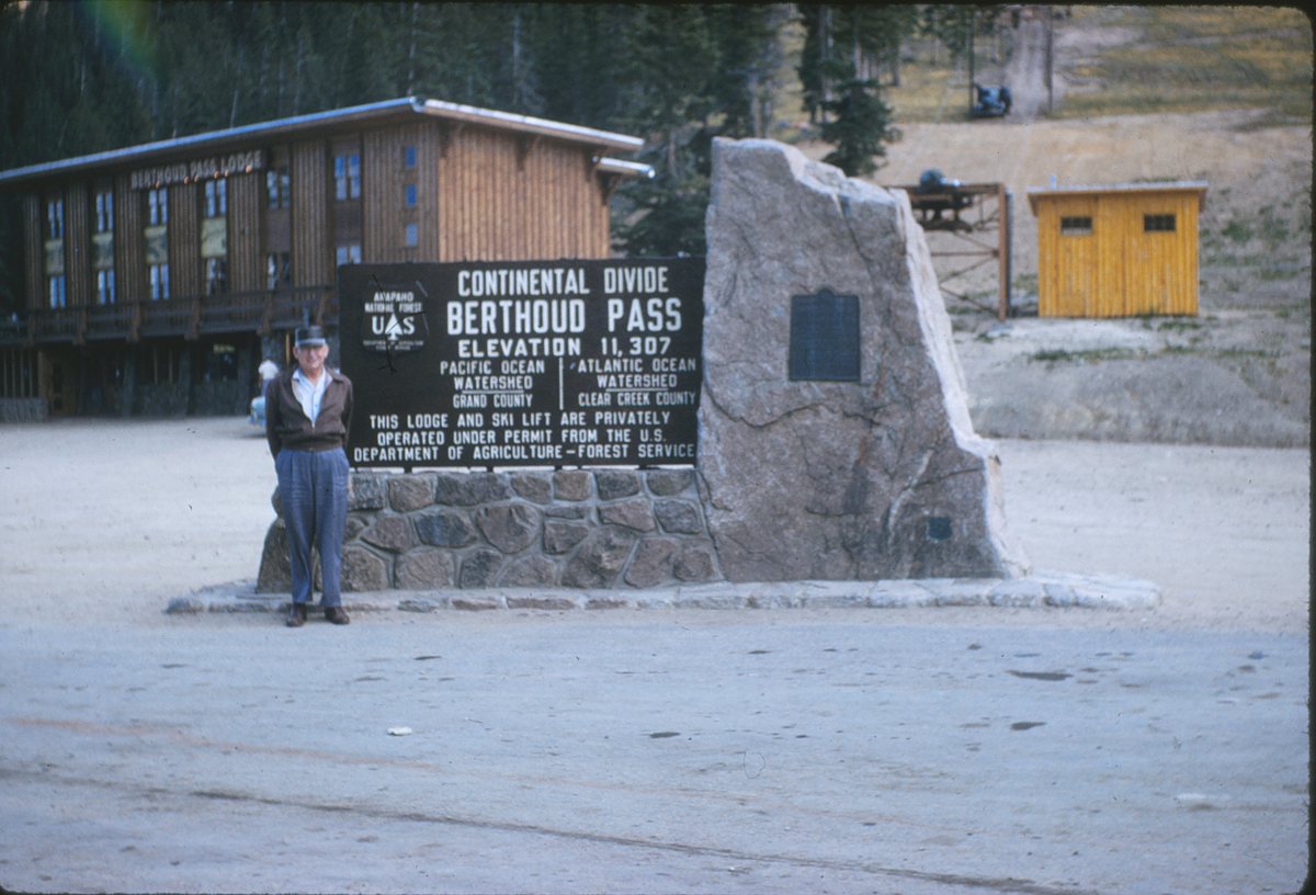
One small thing you can bring home. Nobody agrees how high the pass is. The 1926 guide said 11,313 feet. The bronze plaque says 11,314 and the county history site says 11,315. The Forest Service sign in the 1960s said 11,307, and so does Grand County's visitor bureau today. It depends on who measured and where they stood.
If you drive it in winter, the county's own avalanche primer gives the rules. Keep your windows up under the avalanche paths and steep cut banks, don't stop under them, and don't get out of the car unless you are somewhere safe, like a band of trees that reaches the road. Those big pullouts on the east side look like perfect photo stops. One of them is directly under the Stanley.
Dispatch Notes
I grew up in Empire, at the foot of the east side of this pass. Berthoud was the closest ski area for a local, so that is where we skied.
The run I remember is the Seven Mile trail down the Grand County side. It comes out at the bottom switchback, and from there I would hitchhike back up to the summit.
Sources
- Clear Creek County, US-40 Auto Tour, "MP 249-250: Berthoud Falls" (2012) — Berthoud's 1861 report quoted; Stanley avalanche path data and incident history
- Clear Creek County, US-40 Auto Tour, "MP 236-237: Headwaters of the Fraser" (2012) — Berthoud's summit description; Moses creek; 1862 Rocky Mountain News letter
- Clear Creek County, "History of U.S. Highway 40 over Berthoud Pass" (2012) — 1919-23 auto road, 1926 guide, 1999-2006 widening
- Clear Creek County, "What is an avalanche and are there any on Berthoud Pass?" (Ray Mumford, 2012) — CDOT/CAIC program and driver safety rules
- Grand County History Stories, "Berthoud Pass" — Bridger unaware of the pass; why it went unnoticed
- Grand County History Stories, "Moffat Road" — railroad surveys; Rollins Pass line 1904-1928; Moffat Tunnel
- Historical Marker Database, "Berthoud Pass" plaque — plaque text: discovery, survey, toll road, highway dates
- Federal Highway Administration, "FHWA By Day: July 3" — 1938 completion of the last paved segment of US-40
- Logan & Atkins, "A History of Colorado Avalanche Accidents, 1859-2006," ISSW 2006 — first winter opening 1932-33; 1937, 1945 and 1950s deaths
- Avalanchemapping.org, "Avalanche Paths of Berthoud Pass, Colorado" (2003) — 55 named paths
- The Denver Post, "8 trapped in U.S. 40 avalanche rescued" (Jan. 6, 2007) — Stanley slide sweeps two cars off the road
- The Denver Post, "Remote avalanche control system kept Berthoud Pass open all winter" (May 17, 2016) — Gazex results, 2015-16
- CDOT, "US 40 Berthoud Pass to remain closed overnight" (Jan. 14, 2024) — ten vehicles caught in natural slide
- FHWA, Public Roads, "Saving Colorado's Berthoud Pass" (July/Aug. 2006), archived — pre-1999 road width, traffic, sand, construction rules, awards
- CDOT, avalanche mitigation release (Feb. 2025) — 278 of 522 known highway avalanche paths
- Sky-Hi News, "How Berthoud Pass became one of Colorado's first ski lifts" (Feb. 9, 2024) — 1937 rope tow, funders, first-day deaths
- Colorado Ski History, "Berthoud Pass Ski Area" — 1947 double chair, closure 2001-2003, lodge removal 2005
- Visit Grand County, "Berthoud Pass" — elevation and grades
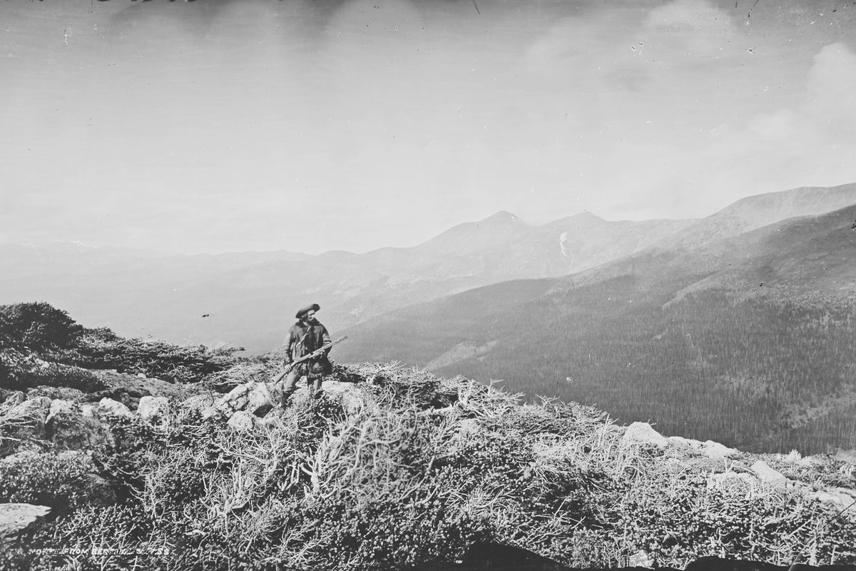
- U.S. National Archives, NAID 517126, W.H. Jackson, 1874 — hero photograph
Frequently Asked Questions
How many trips has Arion completed?
3,314 completed transfers across Colorado since opening on October 17, 2025 with one driver and one vehicle, covering 650,000+ miles.
Has Arion had any accidents?
Zero accidents in more than 650,000 miles. One speeding ticket — no passengers on board, nobody hurt, fine paid.
What percentage of Arion's trips are airport transfers?
More than half — 1,870 of our 3,314 completed transfers since we opened included an airport pickup or drop-off, most of them DEN, plus 490 Eagle County (EGE) transfers into Vail and Beaver Creek. Airport work is heaviest December through March.
Does Arion operate during Colorado snowstorms?
Yes. We've worked through every major Colorado winter storm since opening in October 2025. When flights cancel, the highway becomes Plan B — and demand usually spikes all at once.
How many repeat clients does Arion have?
68% of reservations come from returning clients, and 80.1% of revenue came from repeat clients.
What does it cost to maintain a luxury SUV fleet in Colorado?
Through the first 2,500 trips (all vehicles, plus vetted affiliate transfers, from Arion’s trip and mileage records): $120,807 in fuel, $129,600 in commercial insurance, roughly $12,000 across 83 oil changes, about $25,000 in tires (16 sets of four, plus spares), and $33,611 in routine maintenance covering hoses, transmissions, engines, water pumps, batteries and labor — $70,611 in upkeep on top of fuel and insurance. Mountain driving wears vehicles faster than city driving, and the maintenance schedule reflects that.
How do I book Arion transportation?
Call (970) 703-4995 or visit ridearion.com/contact for a free quote on your itinerary.
Do you offer point-to-point trips as well as hourly service?
Both. Point-to-point is priced for a single transfer such as home to DEN or hotel to a venue. Hourly (as-directed) service keeps the same chauffeur and vehicle for dinners, meetings, tours, and multi-stop nights.
Can I set up a recurring or corporate account?
Yes. Recurring commuters, executive assistants, hotels, and event planners get a standing profile with preferred vehicle, saved addresses, consolidated monthly statements, and priority dispatch.


